Saturday, July 9, 2011

Pre-Ride Day 4: Cameron Pass - Poudre Canyon - Louisville Finish!

Other Segments: Day 1 - Day 2 - Day 3

We push off later the final morning - 4:35am -  the faintest light already ringing the horizon - if nothing else, to see the moose that might be standing in the road before we get too close.

First sun hits the Never Summer Range:


We've just seen an elk in a meadow
and a pair of white-tailed deer (not common in Colorado) jumping the road in front of us.

Here are more wildflowers, which we saw outbound, but were whizzing past too quickly to photograph:


The "real" four-mile climb to Cameron Pass begins:


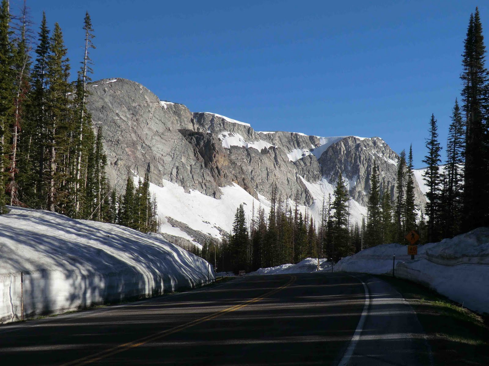
Near the summit, a scenic view of a snowy couloir (I think):


The pass is still in shadow, but we've been warmed by sun on the way up:


Foon stops for a bite in the warming sun (temps in the 30's):


And now it's back to the rushing Poudre River, buoyed by a tailwind:


Most dramatic at the Poudre Narrows (just past the Narrows Campground):


After giant cinnamon rolls at Vern's in LaPorte, we are fortified for the toasty final miles.
We encounter Boulder County cyclists, out for their brief but high-performance outings.
We try to appear fresh.

It's actually only 99ยบ


We have enjoyed this ride immensely and hope you will, too!

-jle

Other Segments: Day 1 - Day 2 - Day 3

Friday, July 8, 2011

Stretch Your Legs!

Looking for a few miles to make sure your legs and bike are still functioning nominally? Here are a couple of short outings from the ride start. Note: both of these are more interesting than they appear on a map! (These maps courtesy of Microsoft Streets & Trips.)


Eldorado Springs - Cherryvale (18 miles) - Cross US-36 and turn right (through the shopping area). Once you summit Davidson Mesa on Marshall Rd. you are into open country with great views of the Boulder Flatirons. This route takes you up South Boulder Creek to the mouth of Eldorado Canyon. You can turn around at the town's "wall," where the road turns to dirt.
Return as you came or via Cherryvale, which is a very pleasant road, and South Boulder Rd. is ok, too.

Morgul Bismark (14 miles) - This is the classic Morgul-Bismark loop (named for Davis Phinney's pets) - a bit more climbing than the other route, but even better views! (Good views of Eldorado Canyon and the Indian Peaks defining the Continental Divide.) Go over US-36 and continue up McCaslin to Hwy. 128, from there to Hwy. 93. Here you can descend the couple of miles to Marshall Rd., or depending on time of day, just come back the way you came. (The 1½ miles on Hwy. 93 are downhill but without shoulder. Not generally a problem, but you be the judge.)
Give either of these a try and soak up some Colorado mountain scenery!

-jle

Pre-Ride Day 3: Gore Pass - Grand Lake - Willow Creek Pass

Other Segments: Day 1 - Day 2 - Day 4

After a quiet climb up the Yampa valley, through sleeping Oak Creek,
the first sunlight hits the snowy Flattops:


There are interesting formations
- like Finger Rock right beside the highway after Yampa -
and these:


Temps have now dropped from the 40's in Steamboat, to the upper 30's at near 8,000 ft.
The store at Yampa has big variety and opens at 5am:


After chatting with the store owner at Toponas,
we make the turn towards Gore Pass:


The entire stretch is quiet and serene, with open meadows giving way to forests.
Here are some of the many wildflowers on the route:


For the Kremmling checkpoint
we choose the Big Shooter cafe,
espresso and other coffees, ice cream, and calorie-rich pastries:


The two-mile climb from Granby to the "lake elevation" brings us to
Lake Granby, with the Continental Divide as backdrop:


The road past Lake Granby to Shadow Mountain Lake to Grand Lake
 rolls slightly upward, which you may notice
after your turnaround at the Grand Lake checkpoint.
Lots of recreation traffic, but good views.

The ascent to Willow Creek Pass starts with a stiff three mile climb,
to get into the proper valley (Willow Creek).
After that it's a gentle most of the way, usually with a tailwind.


Near the pass is a stone wall geologic feature:


Alpine meadows and snowy peaks come into view for the final two-mile jaunt:


The descent actually rolls a fair amount before flattening out at Rand.
Suddenly you break into the expanse of North Park:


A slight tailwind and slight downgrade make for a pleasant end of day:


At least we give a pronghorn antelope something to look at:


The by-now familiar Walden welcome sign,
"Moose-viewing capital of Colorado"


The North Park Inn is convenient and rustic:


With plenty of daylight to spare, on this shorter day,
it's time to reflect while replenishing nutrients and minerals:


So now it's off to bed as the sun sets!

Next: Day 4 - Cameron Pass - Poudre Canyon - Louisville Finish

Other Segments: Day 1 - Day 2 - Day 4

Thursday, July 7, 2011

Pre-Ride Day 2 (July 2): Snowy Range - Rabbit Ears Pass - Steamboat

Other Segments: Day 1 - Day 3 - Day 4

After a quiet first part of the Snowy Range climb, where we saw a moose and her calf, we started the main climb near sunrise.

Soon we reached the snowy elevations:


WYDOT said the Snowy Range road was open
but because of the huge amount of snow, some signs were obscured.

Here's one of them!


Crisp (in the 30's) but with the bright sun, quite comfortable:


 The main formations at Snowy Range Pass come into view:


A similar view from the exploratory ride last July (C. Shenk photo):


After reaching the western summit, you have about five miles of rolling, winding road with dramatic views (including distant views to the Never Summer Range to the south).

Lake Marie is pretty frosty: 


Descending through lush national forest alonside the Little Laramie River,
you suddenly pop out into the Big Hollow:


We saw pronghorn antelope here, as we did heading to Saratoga.

If it's giant snow fences (about two stories high in places)
it must be Wyoming!


This store in Centennial, at the base of the descent, is indeed friendly:


Following the traverse of the Big Hollow to and from Laramie (checkpoint #6), there's a six-mile wooded climb over the shoulder of the Bighorn Range you just crossed.

You descend on a peaceful, green stretch back into Colorado:


The climb from Walden to Muddy Pass is fairly shallow, crossing into a succession of drainages.

These historically preserved (and renewed) metal F. M. Light signs show you're nearing Steamboat Springs, whichever road you're on to get there.
Each advertises a separate product or offering:


From Muddy Pass, it's a three-mile climb to the east Rabbit Ears Pass highpoint.

You can see the rabbit ears to the north:


From eastern highpoint to western highpoint is eight miles of forested road.
Take care on the 7-mile 7% descent - the runaway truck ramp is a clue.

Great views of the Yampa Valley unfold to your left:
you could take a moment to stop on the other side of the road for a better look:


Next: Day 3 - Gore Pass - Grand Lake - Willow Creek Pass.

Other Segments: Day 1 - Day 3 - Day 4

Pre-Ride Day 1 (July 1) - Louisville - Saratoga

This is the first of four travelogues from our pre-ride (July 1-4), designed to whet your appetite (if it needs whetting) and give you a better idea what you'll be biking through.  If you'd rather be surprised, you can skip these posts.

First, a big thanks to my wife Patricia Heller and to Cathy Cramer for supporting the pre-ride, to riding comrade Tim Foon Feldman, and to Catherine Shenk, who did a recon foray with me in July, 2010.

-jle

A nice start to the first day, around dawn near Carter Lake.


Skirting the Devil's Backbone formations near Loveland.


Excellent giant cinnamon rolls at Vern's in LaPorte (checkpoint #2):


The Poudre River is at high levels, in some places only several feet below the road level. 
The rafters are liking it.


Glen Echo resort (checkpoint #3) at Rustic, halfway up Poudre Canyon:


Not the checkpoint, but a great sign:


A reminder to keep up your sodium intake:


The grade increases (but winds may decrease) the final dozen miles of the 57-mile climb.
Snowy peaks come into view as you near Cameron Pass:


The descent from Cameron Pass starts off dramatically.

That straight line is the Mitchell Ditch which you crossed at road level at the pass: it carries water from the Western Slope to irrigate Eastern Colorado.

There are pull-offs on the other side of the road (careful!) if you'd like to take a better look. 
But you'll also be coming back this way in a couple of days.


Soon you enter North Park, a mountain-surrounded plateau at 8,000-8,500 ft.
North Park traditionally has plenty of water and marshland, but especially so this year.
The Arapaho Wildlife Refuge is home to many species.
Marsh and willow landscape is especially attractive to moose.


An appropriately large amount of sky as we enter Wyoming:


Looks easy, doesn't it?


The open, rolling landscape between Walden and Saratoga is especially evocative.
But it's also exposed and does involve some climbing, as the sign indicates:


Soon enough, the terrain eases heading into Riverside and then on to Saratoga.
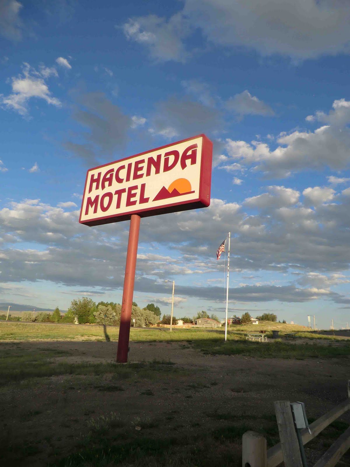
Hacienda Motel, checkpoint #4:


Next: Day 2 - Snowy Range (!) - Big Hollow - Rabbit Ears Pass - Steamboat

Other Segments: Day 2 - Day 3 - Day 4

Monday, July 4, 2011

Post Pre-Ride Q&A!

Tim "Foon" Feldman and I just got back (3:30pm today, Monday) from our pre-ride.  We accumulated a lot of rider tips and some emendations to the cue sheet.  Also many photos.  (Stay tuned.)  Here are some high points, so to speak ...

Re-entering Colorado from Wyoming

  • How were conditions? - Good conditions overall. Chilly in the mornings and descending passes, warm afternoons, some wind.  Representative of typical conditions in the mountains.  Snowpack is way above average, and the landscape is very lush and green.
  • Did you ride the stages as you'd suggested? - Pretty much.  Got off before 4am the second day, 4:10 the third, and "slept in" with a 4:35am departure this morning.  Got in before dark each night, although kind of at dusk the second day (finishing over Rabbit Ears Pass to Steamboat).
  • Is the second day the toughest, as you'd expected? - Yes, it's a bit tougher than the first (all things being equal - but the vagaries of wind, etc., can tilt the tables).  It took longer to do the second day's 200-or-so miles than the 220-or-so miles the day before.  So you should really save yourself on the first day to have something for the second.  After that it's not exactly Easy Street, but you're over the hump.
  • You finished mid-afternoon - is that what we should expect? - Possibly.  It took us 2h45m to climb from Walden to Cameron Pass this morning (30 miles).  It was nice to have the warming sun that final bit of climb up to 10,000 ft., and to have sun a lot of the way down the descent.  There was a crust of ice on some of the standing water at the pass, so that's a clue.  You could start earlier (and be colder - I think we started about right).  Traffic was low most of the descent.
  • Any big surprises? - Not really - more like reminders of what to expect.  It's a tough ride - like all 1200k's, each in its own way - but also beautiful and rewarding.
-jle