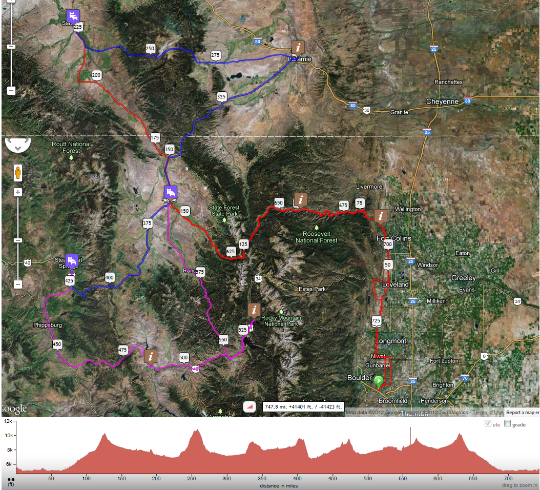
- Places to Sleep - Overnight accommodations are at motels in Saratoga (evening of July 9), Steamboat Springs (evening of July 10), and Walden (evening of July 11).
- Sleeping Arrangements - Riders will be assigned rooms as they arrive, generally double occupancy, depending on the room size.
- Dropbags - Your dropbag will be available by late afternoon of the day when overnight support is offered at the respective motels. You'll need to return the bag to the common area before you departing. (Do not leave them in your room.)
- Food at Overnights - Hot and cold food items will be provided in the evening and the next morning, including items suitable for taking with you the next day. Remember that the first leg of succeeding days can include several hours of riding before encountering any stores or cafes. Example:
- Saratoga over Snowy Range to Centennial (47 mi.) - including 4,000 ft. of climbing
- Other Food at Overnights - There are also supermarkets, convenience stores, and fast food and other restaurants in these towns. (The Saratoga motel is next door to the supermarket, for example.)
- Not Following the Stages? - If you plan not to follow the recommended stages (not sleeping at the overnight venues), let us know. You should be aware that there are long stretches with no towns, or no facilities open overnight, and cold temps at altitude, and our course monitoring is oriented to riding the suggested stages.
- Course Monitoring - You may encounter staff monitoring the course, but for every stretch - especially the challenging ones mentioned in the Hydration post - you should prepare, hydration-wise, etc., as if you won't.
- Phone Reception - As in many remote and scenic areas, cell-phone reception can be spotty, and can vary from carrier to carrier.
- Personal Support - If you have personal support, a reminder that (1) they may only meet you at checkpoints and (2) you must identify them to us at inspection or sign-in so they can be registered and oriented.
